Revisjon per 8. sep. 2021 kl. 07:49 av >Rene
(diff) ← Eldre revisjon | Nåværende revisjon (diff) | Nyere revisjon → (diff)
| Parat |
|---|

Parat av Wenche Strand |
| Tekniske data |
| Lengde (m) | 32,3 |
|---|
| Tonnasje | 135 BRT |
|---|
| Karriere |
| Rederi | Norsk Bergingskompani |
|---|
| Bygget | 1905 |
|---|
| Dykket |
| Nivå | Nivå 3 |
|---|
| Dykkedybde | 45-60m |
|---|
| Posisjon | 61.154 N, 5.017833 E |
|---|
Laster kart... {"format":"leaflet","minzoom":false,"maxzoom":false,"limit":50,"offset":0,"link":"all","sort":[""],"order":[],"headers":"show","mainlabel":"","intro":"","outro":"","searchlabel":"\u2026 flere resultater","default":"","import-annotation":false,"width":"100%","height":"300px","centre":false,"title":"","label":"","icon":"","lines":[],"polygons":[],"circles":[],"rectangles":[],"copycoords":true,"static":false,"zoom":false,"defzoom":14,"layers":["OpenStreetMap"],"image layers":[],"overlays":[],"resizable":true,"fullscreen":true,"scrollwheelzoom":true,"cluster":false,"clustermaxzoom":20,"clusterzoomonclick":true,"clustermaxradius":80,"clusterspiderfy":true,"geojson":"","clicktarget":"","showtitle":true,"hidenamespace":true,"template":"","userparam":"","activeicon":"","pagelabel":false,"ajaxcoordproperty":"","ajaxquery":"","locations":[{"text":"\u003Cb\u003E\u003Ca href=\"/wiki/Parat\" title=\"Parat\"\u003EParat\u003C/a\u003E\u003C/b\u003E","title":"Parat","link":"","lat":61.154,"lon":5.017833,"icon":""}],"imageLayers":[]}
Karthjelpen:
- Når pekeren din er over kartet, vil scrolling endre zoom-nivå.
- Full-skjerm med symbol i øvre høyre hjørnet.
- Dobbelklikk på et område på kartet og du zoomer inn på det.
- For de kart med flere kartlag, kan du velge i øvre høyre hjørnet hvilket du vil se.
- Mer om hvordan opprette kart her.
|
| | | |
Bakgrunn
Location: Sogn & Fjordane
Depth: 45-60M
Skill level: CMAS*** to Trimix
Drive Time from Bergen: 120 Minutes
Local Air Station: Gulen Dykkesenter
dykking
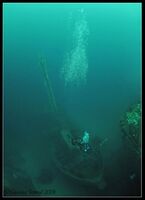
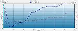
The Parat's Bow is closest to the Stern of the Ferndale and this is at about 44M, a trip down to the bridge of the wreck takes you to 50M, and then further to her stern will find you in about 58M. Lets hope you have the correct gas for that depth, and have planned your decco and gas management, as that is NO PLACE TO BE without the CORRECT TRAINING and EQUIPMENT. For those interested below is a profile of my last dive on the wrecks. Having a comfortable swim around the top half of Parat, with a 50M max depth, had me back to the stern of the Ferndale after about 15 minutes.
For the decco I would certainly suggest divers remain near to Seglsteinen (The rock outcrop) The tide whizzes along Krakhellesundet and is subject to quite heavy boat traffic. If you do end up drifting by accident a DSMB is a must. The fjord drops to 60M+ both sides of you...
Below I have sketched out a rough view of the depths the wreck lies at. Just remember don't blow you max depth, and stay on the rock for the decco!
Other considerations
The wreck is on the charts, and often has a shot line, but I would suggest you use the local dive center, Gulen-dykkesenter, to get onto the wreck. They really know the site and will get you onto the wreck safely, and all importantly over Sognfjorden! For a second dive you can take a short ride down to see Solvang II.
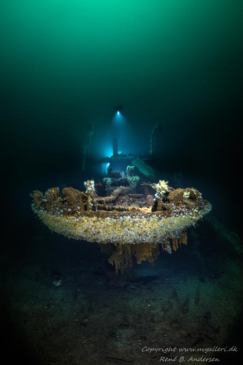
Bilder af René B. Andersen

Copyright www.uvgalleri.dk

Copyright www.uvgalleri.dk

Copyright www.uvgalleri.dk


Ferndale og Parat av Wenche Strand
Film og Bilder
Video by Kjell-Ronnie Grytten May 2015
Film av Jon Ottar Runde:
Linker
Gulen Dykkesenter
Ferndale & Parat av Arve Solli
Nivå
Nivå 3
Trimix
Kart
Laster kart...
{"format":"leaflet","minzoom":false,"maxzoom":false,"limit":50,"offset":0,"link":"all","sort":[""],"order":[],"headers":"show","mainlabel":"","intro":"","outro":"","searchlabel":"\u2026 flere resultater","default":"","import-annotation":false,"width":"100%","height":"300px","centre":false,"title":"","label":"","icon":"","lines":[],"polygons":[],"circles":[],"rectangles":[],"copycoords":true,"static":false,"zoom":false,"defzoom":14,"layers":["OpenStreetMap"],"image layers":[],"overlays":[],"resizable":true,"fullscreen":true,"scrollwheelzoom":true,"cluster":false,"clustermaxzoom":20,"clusterzoomonclick":true,"clustermaxradius":80,"clusterspiderfy":true,"geojson":"","clicktarget":"","showtitle":true,"hidenamespace":true,"template":"","userparam":"","activeicon":"","pagelabel":false,"ajaxcoordproperty":"","ajaxquery":"","locations":[{"text":"\u003Cb\u003E\u003Ca href=\"/wiki/Parat\" title=\"Parat\"\u003EParat\u003C/a\u003E\u003C/b\u003E","title":"Parat","link":"","lat":61.154,"lon":5.017833,"icon":""}],"imageLayers":[]}
Karthjelpen:
- Når pekeren din er over kartet, vil scrolling endre zoom-nivå.
- Full-skjerm med symbol i øvre høyre hjørnet.
- Dobbelklikk på et område på kartet og du zoomer inn på det.
- For de kart med flere kartlag, kan du velge i øvre høyre hjørnet hvilket du vil se.
- Mer om hvordan opprette kart her.


